List Of Northern Cordilleran Volcanoes on:
[Wikipedia]
[Google]
[Amazon]
 The
The
 The central portion of the Northern Cordilleran Volcanic Province extends through Yukon where very few Northern Cordilleran volcanoes exist. Near the junction of the


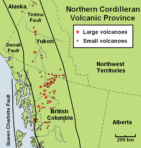
Volcanoes of CanadaMap of the Northern Cordilleran Volcanic Province
{{Northern Cordilleran volcanoes *List Northern Cordilleran Northern Cordilleran volcanoes Cenozoic geology of North America Northern Cordilleran volcanoes Northern Cordilleran volcanoes Northern Cordilleran volcanoes
 The
The geography
Geography (from Greek: , ''geographia''. Combination of Greek words ‘Geo’ (The Earth) and ‘Graphien’ (to describe), literally "earth description") is a field of science devoted to the study of the lands, features, inhabitants, and ...
of northwestern British Columbia
British Columbia (commonly abbreviated as BC) is the westernmost province of Canada, situated between the Pacific Ocean and the Rocky Mountains. It has a diverse geography, with rugged landscapes that include rocky coastlines, sandy beaches, ...
and Yukon
Yukon (; ; formerly called Yukon Territory and also referred to as the Yukon) is the smallest and westernmost of Canada's three territories. It also is the second-least populated province or territory in Canada, with a population of 43,964 as ...
, Canada is dominated by volcano
A volcano is a rupture in the crust of a planetary-mass object, such as Earth, that allows hot lava, volcanic ash, and gases to escape from a magma chamber below the surface.
On Earth, volcanoes are most often found where tectonic plates are ...
es of the Northern Cordilleran Volcanic Province
The Northern Cordilleran Volcanic Province (NCVP), formerly known as the Stikine Volcanic Belt, is a geologic province defined by the occurrence of Miocene to Holocene volcanoes in the Pacific Northwest of North America. This belt of volcanoes e ...
formed due to continental rift
In geology, a rift is a linear zone where the lithosphere is being pulled apart and is an example of extensional tectonics.
Typical rift features are a central linear downfaulted depression, called a graben, or more commonly a half-grabe ...
ing of the North American Plate
The North American Plate is a tectonic plate covering most of North America, Cuba, the Bahamas, extreme northeastern Asia, and parts of Iceland and the Azores. With an area of , it is the Earth's second largest tectonic plate, behind the Pacific ...
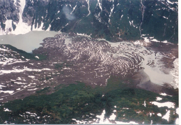
. It is the most active volcanic region in Canada. Some of the volcanoes are notable for their eruptions, for instance, Tseax Cone
The Tseax Cone ( ), also called the Tseax River Cone or the Aiyansh Volcano, is a young and active cinder cone and adjacent lava flows associated with the Nass Ranges and the Northern Cordilleran Volcanic Province. It is located east of Crater ...
for its catastrophic eruption estimated to have occurred in the 18th century which was responsible for the death of at least 2,000 Nisga'a
The Nisga’a , often formerly spelled Nishga and spelled in the Nisga'a language as (pronounced ), are an Indigenous people of Canada in British Columbia. They reside in the Nass River valley of northwestern British Columbia. The name is a ...
people from poisonous volcanic gas
Volcanic gases are gases given off by active (or, at times, by dormant) volcanoes. These include gases trapped in cavities (vesicles) in volcanic rocks, dissolved or dissociated gases in magma and lava, or gases emanating from lava, from volcanic ...
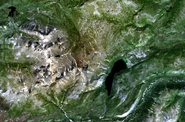
es, the Mount Edziza volcanic complex
The Mount Edziza volcanic complex is a large and potentially active north-south trending complex volcano in Stikine Country, northwestern British Columbia, Canada, located southeast of the small community of Telegraph Creek. It occupies the sout ...
for at least 20 eruptions throughout the past 10,000 years, and The Volcano (also known as Lava Fork volcano) for the most recent eruption in Canada during 1904. The majority of volcanoes in the Northern Cordilleran Volcanic Province lie in Canada while a very small portion of the volcanic province lies in the U.S. state
In the United States, a state is a constituent political entity, of which there are 50. Bound together in a political union, each state holds governmental jurisdiction over a separate and defined geographic territory where it shares its sover ...
of Alaska
Alaska ( ; russian: Аляска, Alyaska; ale, Alax̂sxax̂; ; ems, Alas'kaaq; Yup'ik: ''Alaskaq''; tli, Anáaski) is a state located in the Western United States on the northwest extremity of North America. A semi-exclave of the U.S., ...
.
Volcanoes of the Northern Cordilleran Volcanic Province are a part of the Pacific Ring of Fire
The Ring of Fire (also known as the Pacific Ring of Fire, the Rim of Fire, the Girdle of Fire or the Circum-Pacific belt) is a region around much of the rim of the Pacific Ocean where many Types of volcanic eruptions, volcanic eruptions and ...
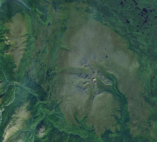
. The largest and most persistent volcanoes are the Mount Edziza volcanic complex and Level Mountain
Level Mountain is a large volcanic complex in the Northern Interior of British Columbia, Canada. It is located north-northwest of Telegraph Creek and west of Dease Lake on the Nahlin Plateau. With a maximum elevation of , it is the second-hig ...
in northwestern British Columbia which have had volcanic activity for millions of years. In the past 7.5 million years, the Mount Edziza volcanic complex has had five phases of volcanic activity while Level Mountain north of Edziza has had three phases of volcanic activity in the past 14.9 million years. The Mount Edziza volcanic complex has been made into a provincial park
Ischigualasto Provincial Park
A provincial park (or territorial park) is a park administered by one of the provinces of a country, as opposed to a national park. They are similar to state parks in other countries. They are typically open to the ...
since 1972 to protect its volcanic landscape. The 102 Northern Cordilleran volcanoes in the list below are grouped into their political regions in north–south order.
Scope
There is no single standard definition for a volcano. It can be defined from individual vents, volcanic edifices or volcanic fields. Interior of ancient volcanoes may have been eroded, creating a new subsurfacemagma chamber
A magma chamber is a large pool of liquid rock beneath the surface of the Earth. The molten rock, or magma, in such a chamber is less dense than the surrounding country rock, which produces buoyant forces on the magma that tend to drive it upw ...
as a separate volcano. Many contemporary volcanoes rise as young parasitic cone
A parasitic cone (also adventive cone or satellite cone) is the cone-shaped accumulation of volcanic material not part of the central vent of a volcano. It forms from eruptions from fractures on the flank of the volcano. These fractures occur ...
s from flank vents or at a central crater. Some volcanoes are grouped into one volcano name, for instance, the Mount Edziza volcanic complex, although individual vents are named by local people. The status of a volcano, either active
Active may refer to:
Music
* ''Active'' (album), a 1992 album by Casiopea
* Active Records, a record label
Ships
* ''Active'' (ship), several commercial ships by that name
* HMS ''Active'', the name of various ships of the British Royal ...
, dormant or extinct
Extinction is the termination of a kind of organism or of a group of kinds (taxon), usually a species. The moment of extinction is generally considered to be the death of the last individual of the species, although the capacity to breed and ...
, cannot be defined precisely. An indication of a volcano is determined by either its historical records, potassium-argon dating, radiocarbon dating
Radiocarbon dating (also referred to as carbon dating or carbon-14 dating) is a method for determining the age of an object containing organic material by using the properties of radiocarbon, a radioactive isotope of carbon.
The method was dev ...
, or geothermal activities.
The primary source of the list below is taken from the Geological Survey of Canada
The Geological Survey of Canada (GSC; french: Commission géologique du Canada (CGC)) is a Canadian federal government agency responsible for performing geological surveys of the country, developing Canada's natural resources and protecting the en ...
website, compiled by the Earth Sciences Sector of Natural Resources Canada
Natural Resources Canada (NRCan; french: Ressources naturelles Canada; french: RNCan, label=none)Natural Resources Canada is the applied title under the Federal Identity Program; the legal title is Department of Natural Resources (). is the depa ...
, in which Northern Cordilleran volcanoes in the past 66.4 million years are listed. The Geological Survey of Canada use a catalogue of volcanoes grouped by volcano fields, lava fields and mountain ranges. The Geological Survey of Canada list is the most complete list of volcanoes in the Northern Cordilleran Volcanic Province, but work of understanding the frequency and eruption characteristics at volcanoes in Canada is a slow process. This is because most of Canada's dormant and potentially active volcanoes are located in isolated jagged regions, very few scientists study Canadian volcanoes and the provision of money in the Canadian government is limited. Because of these issues, scientists that study Canada's volcanoes have a basic understanding of Canada's volcanic heritage and how it might impact people in the future. Therefore, instead of using the dates of recorded eruptions, the Geological Survey of Canada mostly uses geological epochs for estimating when a volcano last erupted. Geological epoches include the Cenozoic
The Cenozoic ( ; ) is Earth's current geological era, representing the last 66million years of Earth's history. It is characterised by the dominance of mammals, birds and flowering plants, a cooling and drying climate, and the current configura ...
(66.4 million years ago to present) and its subdivisions Miocene
The Miocene ( ) is the first geological epoch of the Neogene Period and extends from about (Ma). The Miocene was named by Scottish geologist Charles Lyell; the name comes from the Greek words (', "less") and (', "new") and means "less recen ...
(23.7 to 5.3 million years ago), Pliocene
The Pliocene ( ; also Pleiocene) is the epoch in the geologic time scale that extends from 5.333 million to 2.58Quaternary
The Quaternary ( ) is the current and most recent of the three periods of the Cenozoic Era in the geologic time scale of the International Commission on Stratigraphy (ICS). It follows the Neogene Period and spans from 2.58 million years ...
(1.6 million years ago to present), Pleistocene
The Pleistocene ( , often referred to as the ''Ice age'') is the geological Epoch (geology), epoch that lasted from about 2,580,000 to 11,700 years ago, spanning the Earth's most recent period of repeated glaciations. Before a change was fina ...
(1.6 to 0.01 million years ago) and Holocene
The Holocene ( ) is the current geological epoch. It began approximately 11,650 cal years Before Present (), after the Last Glacial Period, which concluded with the Holocene glacial retreat. The Holocene and the preceding Pleistocene togethe ...
(0.01 million years ago to present).
Political groups
Alaska
The northernmost portion of the Northern Cordilleran Volcanic Province extends just across the Alaska-Yukon border into theSoutheast Fairbanks Census Area
Southeast Fairbanks Census Area is a census area located in the U.S. state of Alaska. As of the 2020 census, the population was 6,808, down from 7,029 in 2010.
It is part of the unorganized borough and therefore has no borough seat. Its lar ...
of eastcentral Alaska. Here, a single cinder cone, dated at 177,000 years old occurs within the metamorphic
Metamorphic rocks arise from the transformation of existing rock to new types of rock in a process called metamorphism. The original rock (protolith) is subjected to temperatures greater than and, often, elevated pressure of or more, causin ...
and granitic
A granitoid is a generic term for a diverse category of coarse-grained igneous rocks that consist predominantly of quartz, plagioclase, and alkali feldspar. Granitoids range from plagioclase-rich tonalites to alkali-rich syenites and from quart ...
composed upland of the Yukon–Tanana Terrane
The Yukon–Tanana Terrane (YTT) is a tectonic terrane that extends from central Alaska through central Yukon and into northern British Columbia, Canada and Southeast Alaska, USA. Extending over 2000 km, the YTT is the largest tectonostratigr ...
. Prindle Volcano is approximately west of the Alaska-Yukon border.
Yukon
 The central portion of the Northern Cordilleran Volcanic Province extends through Yukon where very few Northern Cordilleran volcanoes exist. Near the junction of the
 Yukon
Yukon (; ; formerly called Yukon Territory and also referred to as the Yukon) is the smallest and westernmost of Canada's three territories. It also is the second-least populated province or territory in Canada, with a population of 43,964 as ...
and Pelly rivers in central Yukon lies the Fort Selkirk Volcanic Field. It is the northernmost Holocene age volcanic field in Canada, consisting of a sequence of valley-filling basalt
Basalt (; ) is an aphanite, aphanitic (fine-grained) extrusive igneous rock formed from the rapid cooling of low-viscosity lava rich in magnesium and iron (mafic lava) exposed at or very near the planetary surface, surface of a terrestrial ...
and basanite
Basanite () is an igneous, volcanic (extrusive) rock with aphanitic to porphyritic texture. It is composed mostly of feldspathoids, pyroxenes, olivine, and plagioclase and forms from magma low in silica and enriched in alkali metal oxides that s ...
lava flows. Further south near the capital city of Whitehorse
Whitehorse () is the capital of Yukon, and the largest city in Northern Canada. It was incorporated in 1950 and is located at kilometre 1426 (Historic Mile 918) on the Alaska Highway in southern Yukon. Whitehorse's downtown and Riverdale areas ...
, a group of volcanoes and lava flows were constructed near Alligator Lake possibly in the past 10,000 years.
British Columbia
Over half of the Northern Cordilleran volcanoes are located in northwestern British Columbia. This portion is where the most recent eruptions in Canada and of the Northern Cordilleran Volcanic Province have occurred, including the catastrophic 18th century eruption ofTseax Cone
The Tseax Cone ( ), also called the Tseax River Cone or the Aiyansh Volcano, is a young and active cinder cone and adjacent lava flows associated with the Nass Ranges and the Northern Cordilleran Volcanic Province. It is located east of Crater ...
and the 1904 eruption of The Volcano.
The Northern Cordilleran volcanoes of British Columbia comprises shield volcano
A shield volcano is a type of volcano named for its low profile, resembling a warrior's shield lying on the ground. It is formed by the eruption of highly fluid (low viscosity) lava, which travels farther and forms thinner flows than the more v ...
es, stratovolcano
A stratovolcano, also known as a composite volcano, is a conical volcano built up by many layers (strata) of hardened lava and tephra. Unlike shield volcanoes, stratovolcanoes are characterized by a steep profile with a summit crater and per ...
es, subglacial volcanoes, lava dome
In volcanology, a lava dome is a circular mound-shaped protrusion resulting from the slow extrusion of viscous lava from a volcano. Dome-building eruptions are common, particularly in convergent plate boundary settings. Around 6% of eruptions on ...
s and a large number of small cinder cone
A cinder cone (or scoria cone) is a steep conical hill of loose pyroclastic fragments, such as volcanic clinkers, volcanic ash, or scoria that has been built around a volcanic vent. The pyroclastic fragments are formed by explosive eruptions o ...
s and associated lava plains. The Northern Cordilleran volcanoes of northwestern British Columbia are disposed along short, northerly trending segments which are unmistakably involved with north-trending rift structures including synvolcanic graben
In geology, a graben () is a depressed block of the crust of a planet or moon, bordered by parallel normal faults.
Etymology
''Graben'' is a loan word from German, meaning 'ditch' or 'trench'. The word was first used in the geologic contex ...
s and grabens with one major fault line along only one of the boundaries (half-grabens
A half-graben is a geological structure bounded by a fault along one side of its boundaries, unlike a full graben where a depressed block of land is bordered by parallel faults.
Rift and fault structure
A rift is a region where the lithosphe ...
) similar to those associated with the East African Rift
The East African Rift (EAR) or East African Rift System (EARS) is an active continental rift zone in East Africa. The EAR began developing around the onset of the Miocene, 22–25 million years ago. In the past it was considered to be part of a ...
, which extends from the Afar Triple Junction
The Afar Triple Junction (also called the Afro-Arabian Rift System) is located along a divergent plate boundary dividing the Nubian, Somali, and Arabian plates. This area is considered a present-day example of continental rifting leading to seaf ...
southward across eastern Africa.


See also
*List of volcanoes in the United States
A list of volcanoes in the United States and its territories.
Alaska
American Samoa
Arizona
California
Colorado
Hawaii
/ /[Https://www.sci.news/geology/puhahonu-shield-volcano-08435.html Puhahonu ...
*List of volcanoes in Canada
*List of Cascade volcanoes
*Volcanism of Canada
*Volcanism of Northern Canada
*Volcanism of Western Canada
References
External links
Volcanoes of Canada
{{Northern Cordilleran volcanoes *List Northern Cordilleran Northern Cordilleran volcanoes Cenozoic geology of North America Northern Cordilleran volcanoes Northern Cordilleran volcanoes Northern Cordilleran volcanoes